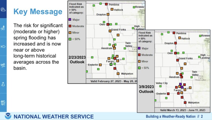
Recent snowfall across the Devils Lake and Red River Basins have increased the likelihood of moderate to major spring flooding.
Amanda Lee is a hydrologist with the National Weather Service in Grand Forks. She says several points along the Red River have been elevated from minor to moderate, with a 50/50 risk of major flooding now indicated at Fargo and Harwood. She says that while below normal soil moisture and near normal streamflows at freeze-up are a positive thing, normal to above normal snowfall and precipitation has followed throughout the winter. She says going forward, the snowmelt timing and thaw cycle will be crucial, along with additional precipitation this spring. Lee says models point to a later snow melt.
"We're getting toward the end of March - normally, with normal temperatures things do start melting a bit. Some years we do see some flooding start in mid to late March. At this time, we're not really thinking that's going to be happening. Probability is looking better and better for a delayed melt this year, pushing into the April time frame. That of course, throws a wrench in things with precipitation; you know, are we going to start seeing more rain instead of snow heading into April. The later and later we get before we start melting, the riskier and riskier it gets."
At Devils Lake, Lee says probability of about a foot of rise on the lake is at about 50 percent.

