As most North Dakotans know, the Red River and its tributaries flow into Hudson Bay while the Missouri River and its tributaries flow into the Gulf of Mexico. It might surprise you but there are several major drainage basins in the state. The maps I have seen vary somewhat, but often place the Missouri Coteau within the Missouri River drainage and the Prairie Coteau and Turtle Mountain in the Hudson Bay drainage even though they are largely pothole country with closed drainage.
As one might expect, there is the Red River of the North Basin which is largely the Red River Valley. The tributaries here in North Dakota include the Sheyenne, Wild Rice, Maple, Elm, Goose, Turtle, Forest, Park, Tongue, and Pembina rivers. And of course, there are rivers on the Minnesota side as well.
The Souris River along with its tributaries, the Des Lac for example, constitute the Souris River Basin which flows into Manitoba, merging with the Assiniboine River southeast of Brandon, Manitoba and eventually the Red River in Winnipeg.
The Devils Lake Basin is sometimes considered to as a closed basin, but as some of you know, there is a natural outlet into the Sheyenne River, so it is often considered to lie within the Hudson Bay Drainage along with the Red River and Souris River Basins.
The Missouri River Basin generally includes the area of the state south and west of much of the Missouri Coteau, a band of hills (30 miles wide more or less) along the north and east side of the Missouri River. That is pretty much true for the area to the north and west of the New Rockford-Sheyenne area, but it takes a turn here.
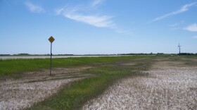
When traveling the gently rolling landscape of highway 281 between Sheyenne and New Rockford one cannot help but notice the sign “Continental Divide, 1619 feet.” The sign identifies the continental divide between the Sheyenne River which flows into the Red River and the James River which flows into the Missouri River near Sioux City. So, the Continental Divide curves around to the east and then southward to include the James River watershed within the Missouri River Basin.
Overall, the Missouri River and James River basins cover just under half of the state while the Hudson Bay drainage via the Souris and Red River basins is about 40%, including the Devils Lake Basin. If you cut out the Missouri Coteau, Prairie Coteau, and Turtle Mountain, they cover about 13%.


