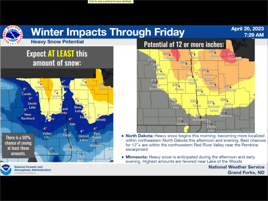
Much of eastern North Dakota is currently under a winter weather advisory, with the northeastern corner of the state elevated to a winter storm warning through Friday night and possibly Saturday morning.
Grand Forks National Weather Service hydrologist Amanda Lee says while no one wants to see any more snow, it’s looking as though impacts to spring flooding will be minimal in the Red River Valley.
"We are getting a better handle on that snowmelt flow, on the Sheyenne and the Maple and such - all that southeast North Dakota area. With us getting a better handle on the water finally entering the system, we have a little bit more certainty and what crest levels should be along the mainstem."
Nathan Rick is a meteorologist with the National Weather Service. He says the system working its way through today will linger through tomorrow and even into Saturday morning as well, with wintry mix switching all over to snow. Northernmost areas will see the highest accumulations, with six inches being a high probability and up to a foot possible as well. He says for anyone traveling – caution should be taken on the roadways.
"Travel is going to be impacted by this, just from accumulating snowfall - we're probably going to see some slushy accumulations, especially as we get into the overnight, evening hours as the temperatures start to cool - we should start to see more of that accumulation on pavement. We want to reiterate here that, with deteriorating road conditions, any slide-offs into ditches that are already filled with water with our already ongoing flooding could just exacerbate impacts there."

