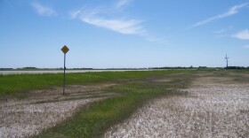
The next time you travel on Highway 83 between Minot and Bismarck, or other areas along the east side of the Missouri River, take a closer look at the landscape of the Coteau Slope.
We generally regard the portion of North Dakota northeast of the Missouri River as glaciated, while the area southwest of the Missouri River has an unglaciated, erosional topography. That is, however, a broad generalization.
Many maps of North Dakota’s surface geology, for example a map in the book "North Dakota’s Geologic Legacy" by John Bluemle, will show a narrow band of land adjacent to the Missouri River on the north and east that is characterized by a mixture of glacial and erosional features.
That landscape is what geologists call the Coteau Slope. It’s an area of rolling, hilly plains near the margins of the glaciers during the last ice age. Some of the glacial deposits here are comparatively thin and did not significantly alter the topography.
Perhaps the best place to view and better understand the geology of the Coteau Slope is to drive on Highway 83 between Minot and Bismarck. The landscape between Minot and near Lake Audubon is typical for glaciated country. The topography is rolling to hummocky, rock piles are conspicuous in many fields, and prairie potholes are evidence that the area was glaciated.
But the landscape takes on a different character along much of Highway 83 from roughly Lake Audubon to Bismarck, and even more so between Wilton and Bismarck with its broad sweeping landscape and occasional outcrops of bedrock. You will not see many rockpiles in the fields, and few if any prairie potholes along that stretch of highway. The Coteau Slope is also noticeable in several areas along the Missouri River, as well as along Highway 83 southward from Bismarck to the South Dakota border.
So, take a closer look at the landscape of the Coteau Slope. Some parts have easily identified evidence of glaciation while other areas, well, not so much. You will get a better understanding and appreciation of North Dakota’s geological heritage.
Further Reading
- Bluemle, John. 2016. North Dakota’s Geologic Legacy. North Dakota State University Press, Fargo, ND 382 pages.
- Bluemle, John. 2000. The Face of North Dakota-third edition. 210 pages. North Dakota Geological Survey Educational Series 26.
- No Ordinary Plain: North Dakota’s Physiography and Landforms (John Bluemle and Bob Biek, North Dakota Geological Survey)
- https://www.dmr.nd.gov/ndgs/ndnotes/ndn1.asp


