When the Bakken Formation in Western North Dakota sparked an oil boom, the state received national attention for it. The combination of new drilling techniques and high oil prices created incredible wealth for the state. Even though the boom has subsided, the region still has the capacity to produce a lot of oil. However some oil wells are close to federally protected lands like Theodore Roosevelt National Park and the Little Missouri National Grassland. The following is an audio interview and narration transcription with Badlands Executive Director Jan Swenson during a tour of Western North Dakota’s oil country.
JAN SWENSON – (Describing Highway 85 North between Belfield and Watford City) “This was not here, this was not here, but at any rate. This highway, there is an active proposal to 4-lane this highway.”
(Describing how the Badlands Conservation Alliance was formed) “We started as a small group around a kitchen table concerned about conservation issues in the badlands of Western North Dakota. Oil was an issue but looking back it was minor compared to the kind of concerns that we have now.”
NARRATION - The Badlands Conservation Alliance (BCA) was also focused on issues in the Little Missouri Grassland like wildlife, and grazing management. Their primary focus now is on oil and gas ever since the Bakken oil boom.
SWENSON - “There’s just no getting around it. Because it isn’t just about the wells, it’s about all the infrastructure that comes with oil wells. Whether it’s rail transport, or refinery’s, or gathering pipelines or larger pipelines, truck yards, pipe yards, saltwater disposal wells. There’s so much infrastructure that comes with the oil and gas industry.”
NARRATION - But protecting the badlands isn’t all they do.
SWENSON - “We have another mission which is to get people out here. Share the knowledge of the individuals that are members so that we love it. You don’t fight to protect something unless you know it and love it.”
NARRATION - Our tour began from the town of Belfield, about halfway between Dickinson and the south unit of Theodore Roosevelt National Park off of I-94. The road we’re taking is Highway 85 North. Our destination is Watford City, about an hour away, and one of the towns most impacted by the oil boom. The road runs next to, and through, parts of the Little Missouri Grassland. The grassland is also home to all three units of Theodore Roosevelt National Park.

SWENSON - “Highway 85 has been referred to as the sacred corridor.”
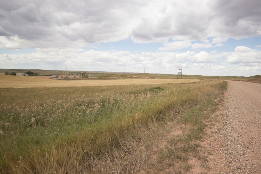
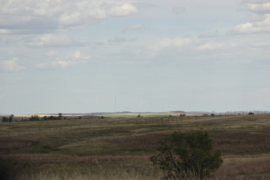
NARRATION - This stretch of road goes through a classic rolling hills, mostly treeless, Great Plains landscape. Along the highway are ranches, farms, and in some areas, badlands. Also mixed in are scattered oil wells.
SWENSON – “The Bakken came on so rapidly and the extent of development, the technological leaps forward that were made during those initial five years, after the boom began. The state of North Dakota was not ready for that. The communities were not ready for it. I would say that the managing agencies out here of public lands were not ready for it.”
NARRATION - Swenson even believes there are members of oil industry that have concerns.
SWENSON – “I think that there are people within the industry that would like North Dakota, and particularly the North Dakota Industrial Commission to take a stronger leadership role. There are people involved in oil companies that have been in North Dakota for decades that have the same love of place that I have. But their business is oil and gas development. And yes, there are many more folks from outside of North Dakota that don’t have the strong ties with this landscape. So I’m not gonna just say that industry is the bad guys. At the same time we live in a capitalistic country. They want it. They want it as fast and efficiently as they can get it.”
NARRATION - The story of land management is a complicated one. Picture this; you’re looking at Western North Dakota on Google Maps. Around the national park, the map is green, the classic indicator of wild lands, like forests, or in this case, grasslands. You’d probably assume it’s all government land that’s protected the way a national park is. But not all of it is.
For one, some of the land is privately owned. Even the land that is government owned isn’t necessarily protected like a national park. That’s because there are different government agencies that own the other land. Those agencies have different missions, and therefore use their land differently.
Here’s an example: the mission of the Forest Service is to “sustain the health, diversity and productivity” of land they manage and to “meet the needs of present and future generations.” Forest Service lands, like the Little Missouri, can be leased to developers for use under monitored supervision.
SWENSON – “Of the one million acres of the Little Missouri National Grassland, 95 percent are open to oil and gas development.”
NARRATION - They decide how much of their land can be developed on, and how much is off limits. Of the over one million acres of the Little Missouri National Grassland, around 46,000 is set aside as off limits. That’s less than five percent. The rest has already mostly been leased, or can be leased for development. A few of the off limit areas are next to the national park.

SWENSON – “I would say at this point in time they are particularly important because they not only, shall we say buffer the north unit of the park, but they work ecologically with the north unit of the park.”
NARRATION – But then what about all the private land in the Little Missouri National Grassland region? If the land is private, that must mean it can’t be drilled on unless landowners give consent, right? Except it doesn’t. That’s why the surface map doesn’t tell the whole story. The rest of the story is actually buried under ground.
SWENSON – “Just because a private rancher owns the surface doesn’t mean that he or she necessarily owns the minerals beneath it. It’s called split estate. They can be purchased separately.”
JOHN CORLEY – “(But) if I own the land on the top and somebody else owns the minerals on the bottom, can’t I control or decide whether or not somebody is able to come in and put an oil rig on my land, because that’s affecting the surface right?”
SWENSON – “No. Minerals have dominance”
CORLEY – “So you could come into my backyard and drill for oil essentially?”
SWENSON – “Basically yes. Which is really sad, because we live in agricultural North Dakota and in my estimation and I would presume the majority of North Dakotans, the level of respect that we have for agricultural producers and the recognition of how long agriculture has held that high place. It’s pretty tough to see industrialization laid over those agricultural lands with limited opportunity for the surface owners to say how things should be done. There’s no way a surface owner that doesn’t own the minerals can just say no.”
NARRATION - At this point we’ve reached the intersection of U.S. Highway 85 and State Highway 200. Still about 34 miles south of Watford City.
SWENSON – “200 crosses the entire middle part of the state of North Dakota, east to west. And there didn’t use to be anything here.”
NARRATION - We pull into a Shell gas station.
SWENSON – “Over here where you see the big tankers, that’s a pipeline access. And behind used to be a little, I don’t know, 25-30 foot square electrical facility over there. Now it’s huge. Highway 200 here was similar to what Highway 85 had been. Almost a little more dangerous in my estimation in that was so narrow. I mean it was like being in a parade. A caravan. So you had a little Honda car between five big semi’s.”
NARRATION - 20 miles later, Highway 85’s landscape has changed as it winds through the eastern edge Theodore Roosevelt National Park’s badlands.

SWENSON – “Theodore Roosevelt is a small park not everybody knows about Theodore Roosevelt National Park the way they do about the Grand Canyon, or Yosemite, or Yellowstone. When the Bakken came to North Dakota we suddenly were hitting the headlines across the nation. And for a few years we were wealthy and people whose children had left North Dakota, because they had to in order to provide for their families, were able to come back. That’s huge. That’s family. That’s love. And can’t blame people for appreciating that. But there are also negatives, and we need to be dealing with those. Because industry isn’t going to stop. They’re not going to curtail their activity unless it becomes a requirement.”
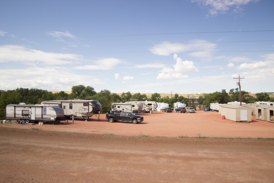
NARRATION – At this point we’re in the greater Watford City area. Jan takes us onto a bumpy gravel road that leads to an oil pipeline receipt station and a gas plant. Both of these are next to a trailer park.
SWENSON – “All of this is obviously new.”
CORLEY – “They call it the Roosevelt gas plant, huh?”
SWENSON – “Yes, and the Highway 85 project is called Theodore Roosevelt Express Way. Which just slays me.”
NARRATION - At this point of the tour, Jan gets overwhelmed remembering driving through at the height of the boom.
SWENSON – “Here’s this woman, living in some little parking lot belonging to some associated company that has to do with oil and gas, and the place that she has to take her kid, her little kid, toddler, an infant, for a stroller ride is on the same road as these big oil trucks. That’s what Watford City was at one time. And to me that was shocking.”
NARRATION - We get back onto the main road and head into the heart of Watford City. Almost everything either is new, looks new, or is under construction.
CORLEY – “Now it looks like we’re approaching some hotels?”
SWENSON – “Which are new.”
CORLEY – “Most of what you’re seeing is new.”
SWENSON - “It’s kinda sad in that communities like Watford (City), and I have a lot of respect for how Watford (City) tried to keep up and to keep quality of life and to welcome new people into their community. But a lot of these became complete and available just as things were slowing down.”

CORLEY – “I feel like the new outnumbers the old.”
SWENSON – “It does! Seems overcooked, seems overdone at this point. But it is part of a plan and should oil and gas kick in again they are going to be a lot better equipped than they were 10 years ago.”
NARRATION - The U.S. Census says Watford City’s 2010 population was around 1,700. Five years later in 2015, the population grew nearly 300% to around 6,700.
SWENSON - “It’s like you’re driving through town today, if you didn’t know what was new and how Watford (City) had been before, you wouldn’t see it. And the same is true in the countryside. If you didn’t know what was there before, if you didn’t know what the possibilities are, you wouldn’t see it.”
CORLEY – “Do you think that the Bakken, that Western North Dakota is more at-risk because people might not be as aware of it or that it’s so new as opposed to other areas that might be rich in oil?”
SWENSON – “Absolutely I do. It’s a major thing in an isolated part of the state, in a low population part of the state. The people don’t live here. The majority of people in North Dakota don’t live here. Some of them have never been here.”

CORLEY – “Out of sight out of mind?”
SWENSON – “Right. What they see is the money. What they see is that we have a new heritage center and that their water projects can get done or their new buildings at a university. They don’t see the impacts or recognize the loss. If you have never seen something, how can you grieve its loss?”
CORLEY – “What if there was an oil patch found in the Red River Valley? And they’re like “ohhhhh we need to develop here,” like, would people be like “oh no we don’t want this here?””
SWENSON – “If the Bakken were in the Red River Valley, I would not expect people to turn it away. There would have been a large awareness of it, and there would have been controls put on, early on. It would be competing with rich Red River Valley soil. Landowners and agro’ businesses would have been saying, “wait a minute, you know there are other values here.” And that’s what we’re looking for. What we’re looking for is that controlled big picture comprehensive planning that says this is the direction we’re going. We’re going to do it the very best we can, protecting the values and the landscape, the values and our communities, and the landscapes that make North Dakota, North Dakota. That make it home.”

CORLEY – “If there wasn’t awareness spread, if your objectives don’t happen, what do you think would become of Western North Dakota?”
SWENSON – “If we do not speak up for our place and quality of life that it will be gone. We’ll have to settle for what someone else gives us.”

